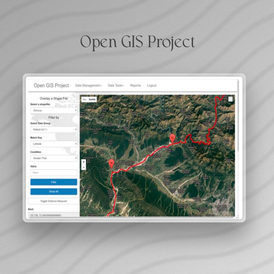
Open GIS Project
Real-Time GIS Framework for Environmental Monitoring
Institution: Amity University, Noida, India
Advisor: Madhuri Kumari, Nitasha Hasteer
Project Description
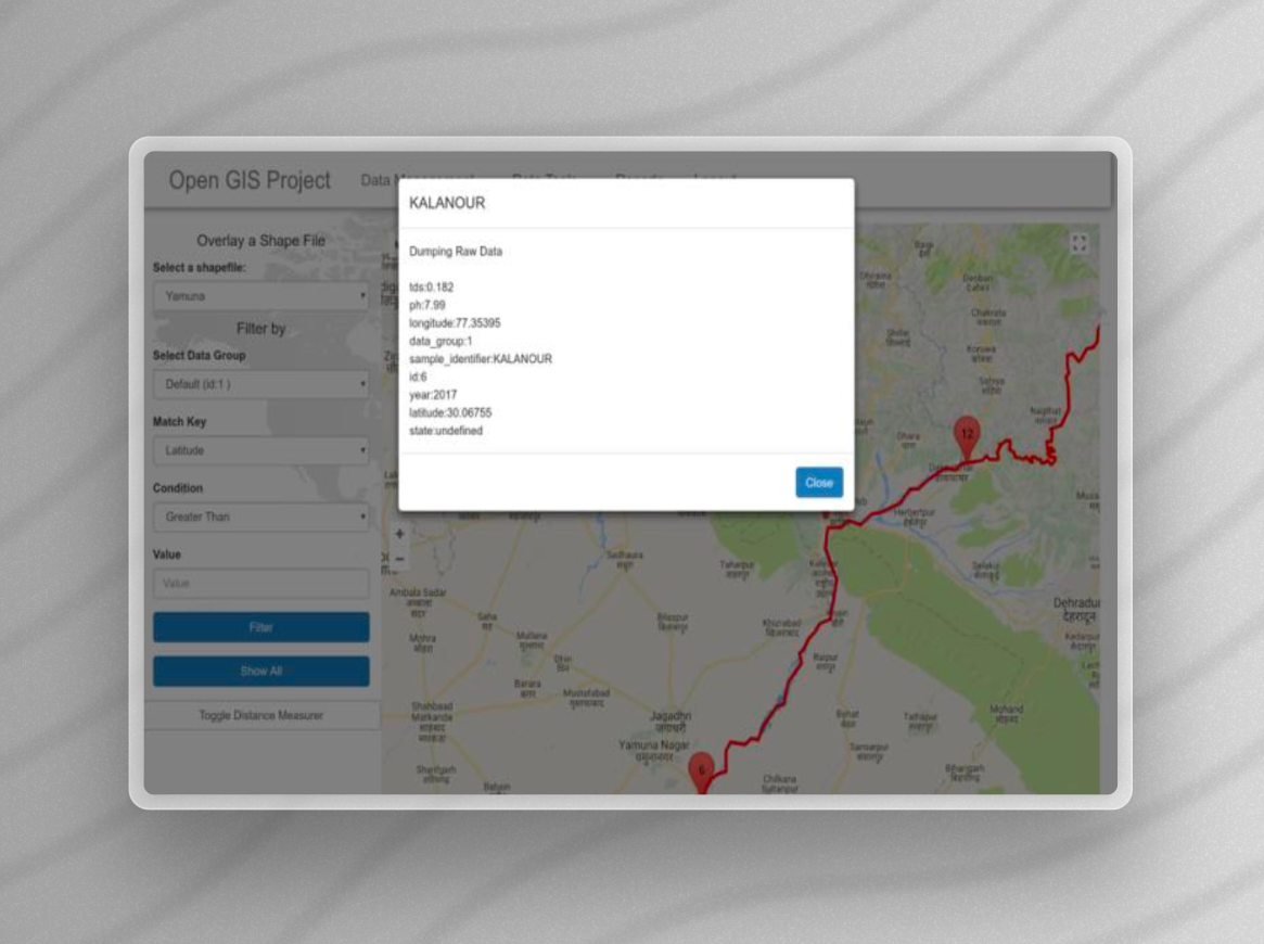
Developed a robust web-based Geographic Information System (GIS) leveraging open-source technologies to monitor environmental phenomena, such as river pollution levels. The solution integrates spatial data management across various geographic locations, providing a scalable and intuitive tool for environmental researchers and decision-makers.
Objectives
- Facilitate the real-time visualization and management of environmental data.
- Employ cost-effective, open-source tools to ensure wide accessibility and adaptability.
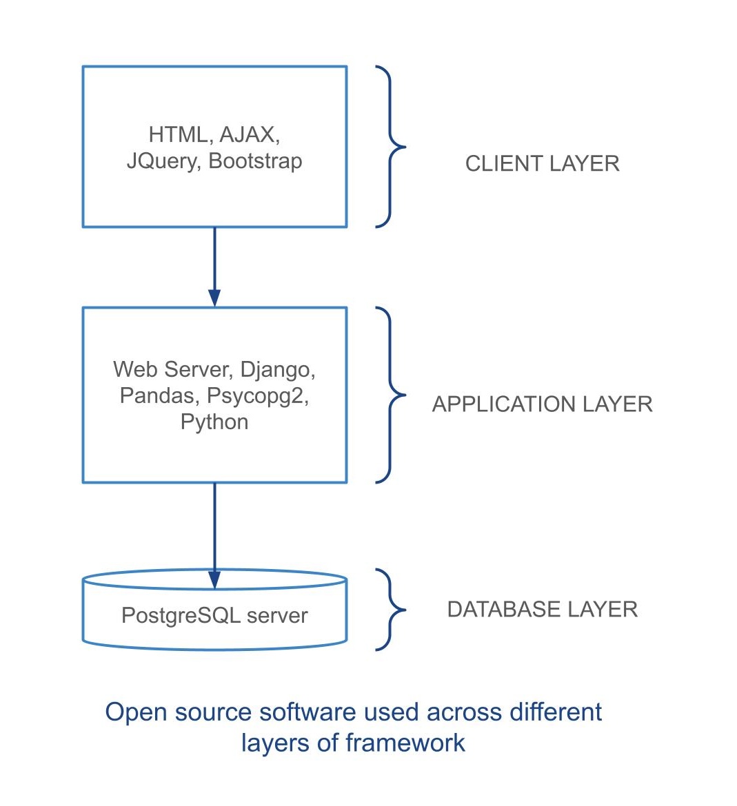
Comprehensive Technology Stack
- Frontend: HTML, CSS, JavaScript, AJAX, jQuery, Bootstrap
- Backend: Django, used for handling API requests, data management, and server-side logic.
- Database: PostgreSQL, for secure and scalable data storage.
- GIS Tools: QGIS, SAGA GIS for spatial data analysis and management.
- Data Analysis and Visualization: Pandas for data handling and manipulation, Google Charts for creating dynamic, interactive graphical representations of data.
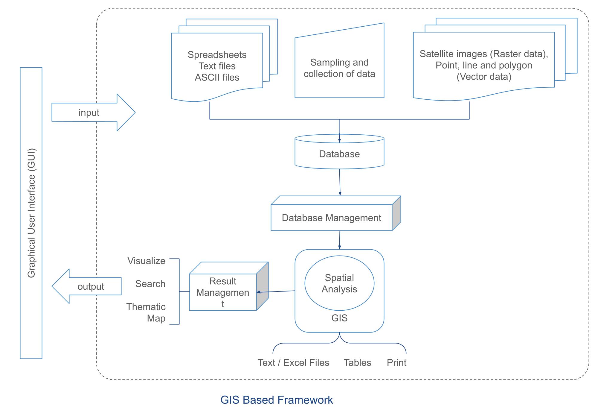
System Architecture
The architecture is structured into three layers:
- Client Layer: Employs AJAX and jQuery for responsive user interactions and real-time data updates.
- Application Layer: Django serves as the backbone, managing authentication, database interactions, and API integrations.
- Database Layer: Utilizes PostgreSQL to manage both spatial and non-spatial data efficiently.
Key Features and Innovations
- Dynamic Data Visualization: Interactive maps and graphs allow for comprehensive analysis and reporting of environmental data.
- Advanced Data Management: Supports multiple data formats and facilitates seamless data input and manipulation through a well-designed GUI.
- Enhanced User Experience: Features such as map zooming, shapefile overlaying, and real-time filtering enhance user interaction and data accessibility.
Impact and Significance
This project supports critical environmental initiatives, such as the monitoring and management of river pollution. By leveraging advanced GIS capabilities and open-source technologies, the framework aids in making informed decisions that significantly impact community health and environmental preservation.
Conclusion
This GIS framework demonstrates the power of integrating open-source technology with advanced data analysis tools to address environmental challenges. It is a pivotal solution for researchers and policymakers aiming to enhance environmental monitoring and decision-making processes.